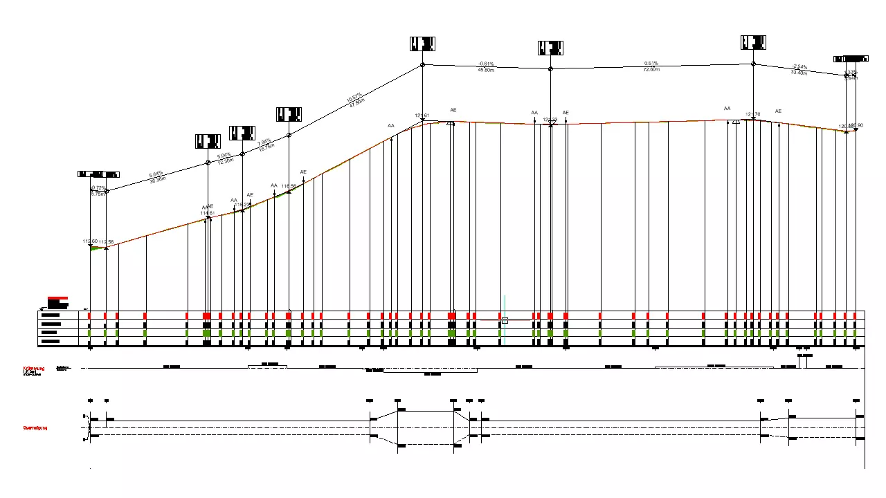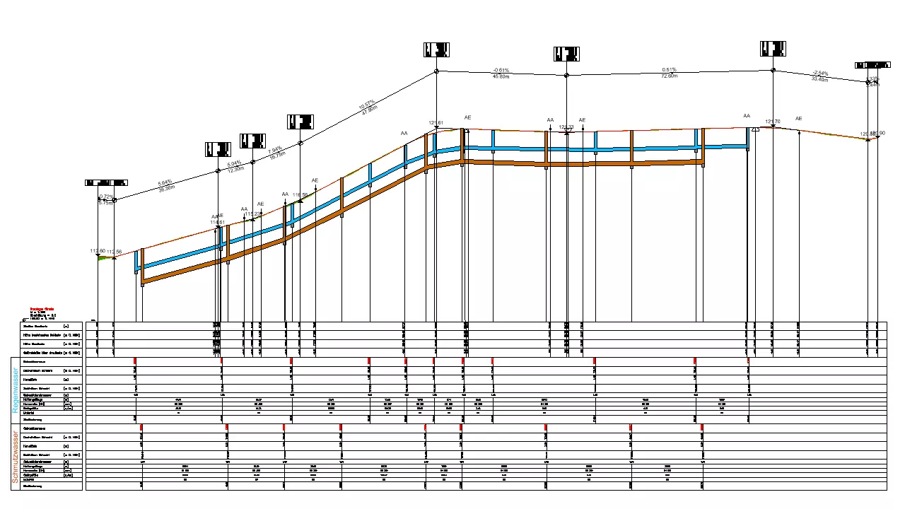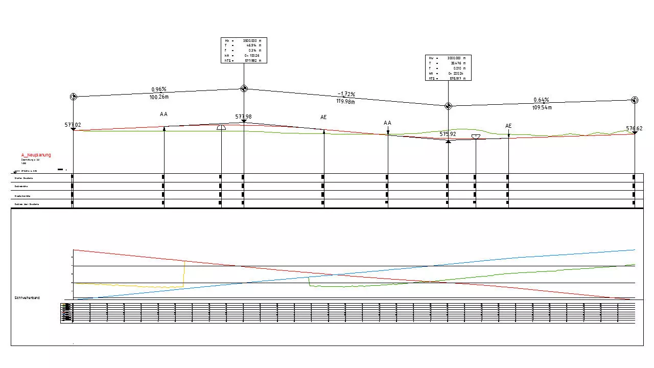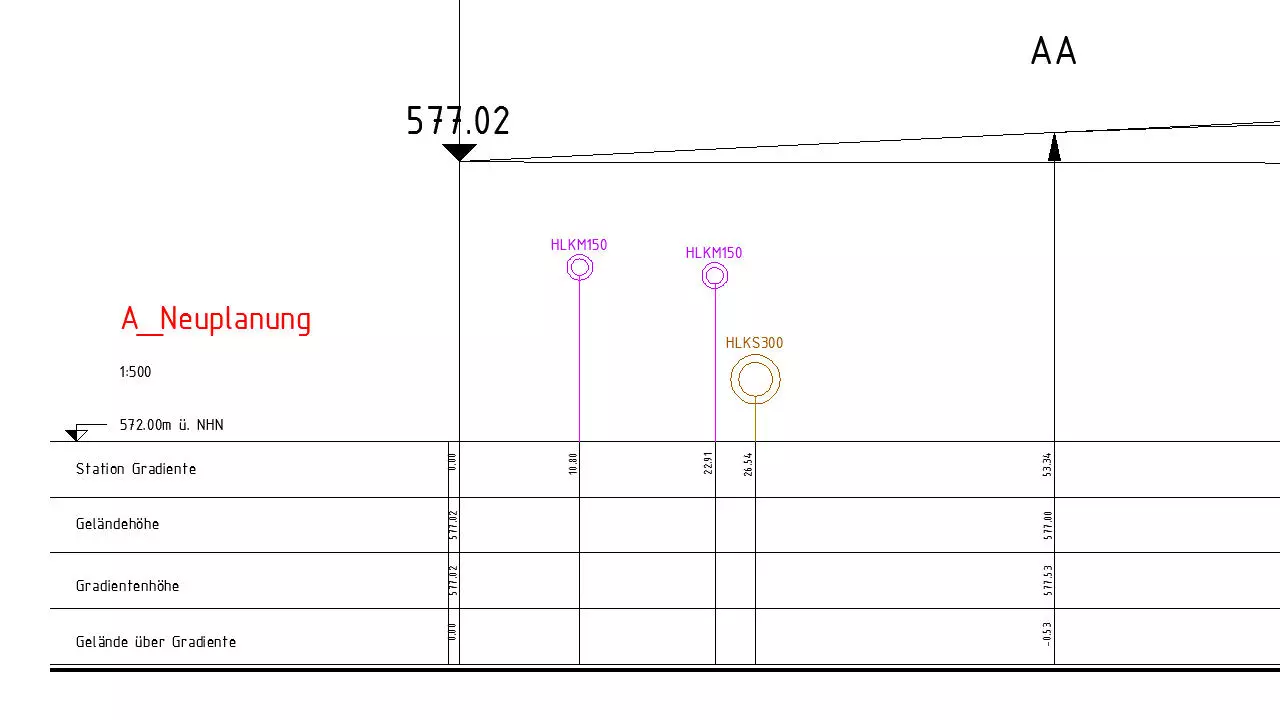
Longitudinal section
The contour map illustrates the longitudinal section of the alignment and the terrain in the alignment. BBSoft® supports you by the automatic generation of a contour map and the therewith connected vertical alignment connection with the help of an existing terrain model (3D-surfaces). Longitudinal gradients and heights of tangents are editable in the list view, beyond that, the software permits an interactive editing in the plotted section. New tangent points can be induced and modified by mouse-click. The program automatically calculates the lenghts and inclinations of the tangents newly and updates these in the section. This tool is also suitable for the water- and dam planning through the flexible application and the extensive adjustment- and presentation options.
Further features:
- interactive adjustment of summits and basins in the drawn longitudinal section
- additional display of curvature, slopes and longitudinal gradients
- stopping and overtaking sight distance can be displayed as separate strings
- adjust the vertical alignment automatically to an existing terrain
- presentation based on RE
- parallel supply lines (gas-, water- or sewer conduits) are considered and processed as separate strings
- edge- and embankment courses can be shown beside the vertical alignment
- crossing elements in in terms of CAD-polylines/-blocks (e.g. supply lines, building points,..) can be displayed as symbols in correct position
- formation level can be drawn additionally
- connecting alignments were considered
- several terrain models are possible
- optional display of bend and slope string
- display of a sight distance string
- 3D-solids (e.g. bridge structures) can be illustrated
- vertical alignment can be generated from a CAD-polyline in the drawn longitudinal section
- filling and cutting areas, humus and formation level can be drawn
- adjoining alignments/polylines can be mapped in separate strings
required modules: BB-VGR, BB-VSTR