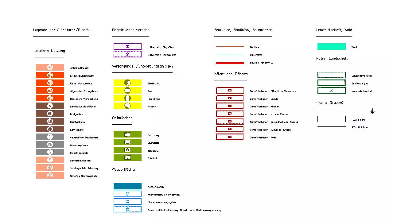
Standard for map symbols
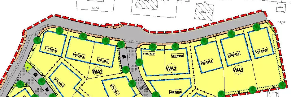
The civil engineering software BBSoft® contains an easy handling of land use-, land development and urban plans under consideration of the standard for map symbols 1990. An appealing plan design is easily possible with the help of symbols, line types and fillings of the surfaces.
Further features:
- XPlanung: import of land development plans according to BauGB and BauNVO
- creation of high-quality land-use plans
- automatized creation of map symbols via a conversion table
- surfaces are shaded automatically and assigned with the essential symbol
- changes of scale are possible: the symbols will be adjusted to the new scale
- check created map symbols upon plausibility and list discrepancies in a dialogue
- check routines prevent the accidentally creation of double surfaces
- optical warnings inhibit the transformation of already assigned symbols
- a legend can be created in the model- or layout section
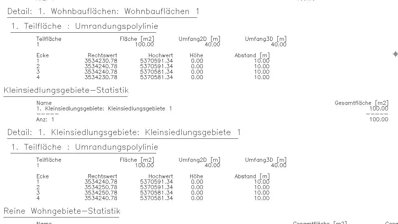
- output of a detailed surface statistics
- own elements and symbols can also be created for plan design
required modules: BB-VGR, BB-VPLV