GIS
Our GIS- information system, based upon the free of charge Oracle®-XE-database, offers engineering offices and communes the possibility to represent and to administrate specific geodata functionally, easy to use and clearly arranged.
Through the optional CAD-connection additional possibilities are available for the user for the graphical editing, for the plannings, calculations and for alternative presentation possibilites.
BBSoft® helps you to stay flexible as an user, because with our GIS-system you can generate quickly, uncomplicated and without additional costs your own application modules with associated technical data masks.
BBSoft® makes i.a. the following GIS - application modules available:
- property cadastre (parcels of land, buildings, borders, lease, topography)
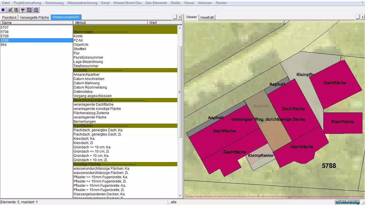
- split sewer charge (sealed surfaces)
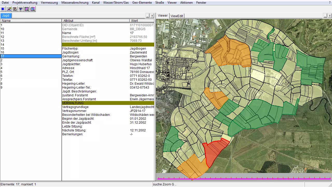
- hunting cadastre
- mobile mapping
- cemetery cadastre/cemetery administration
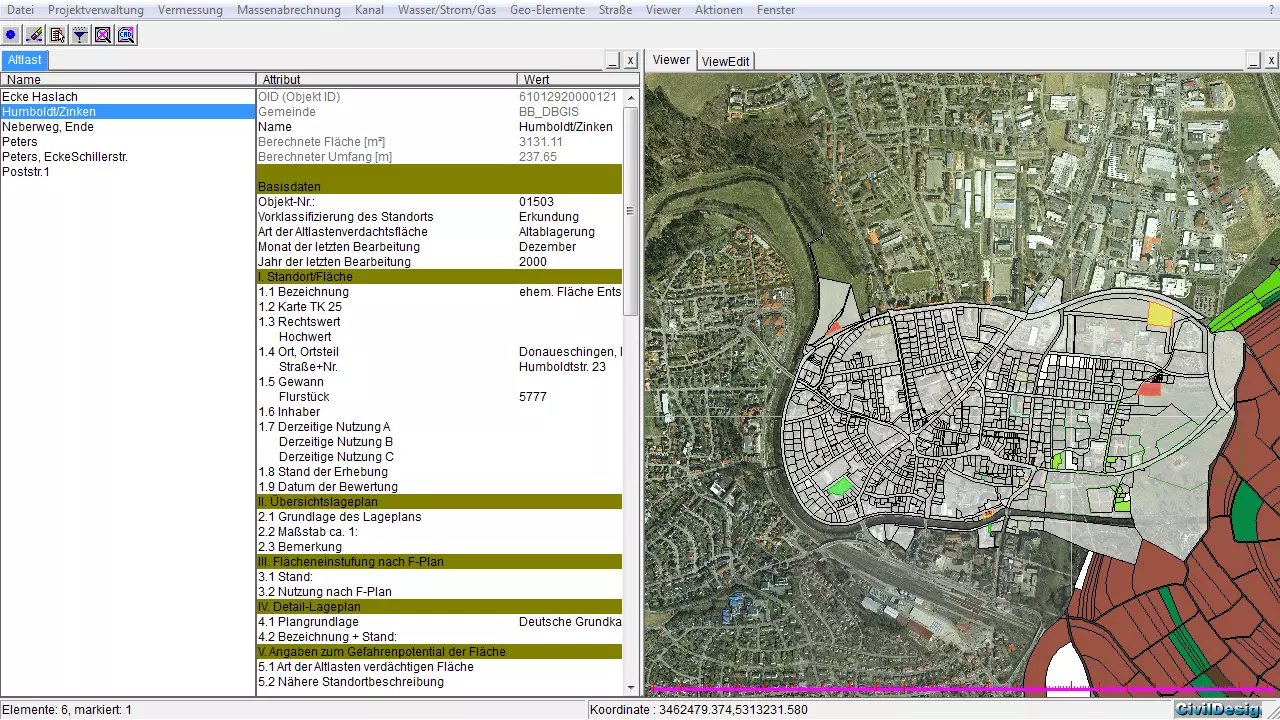
- environment (green area, tree, stream, dangerous waste, recycling)
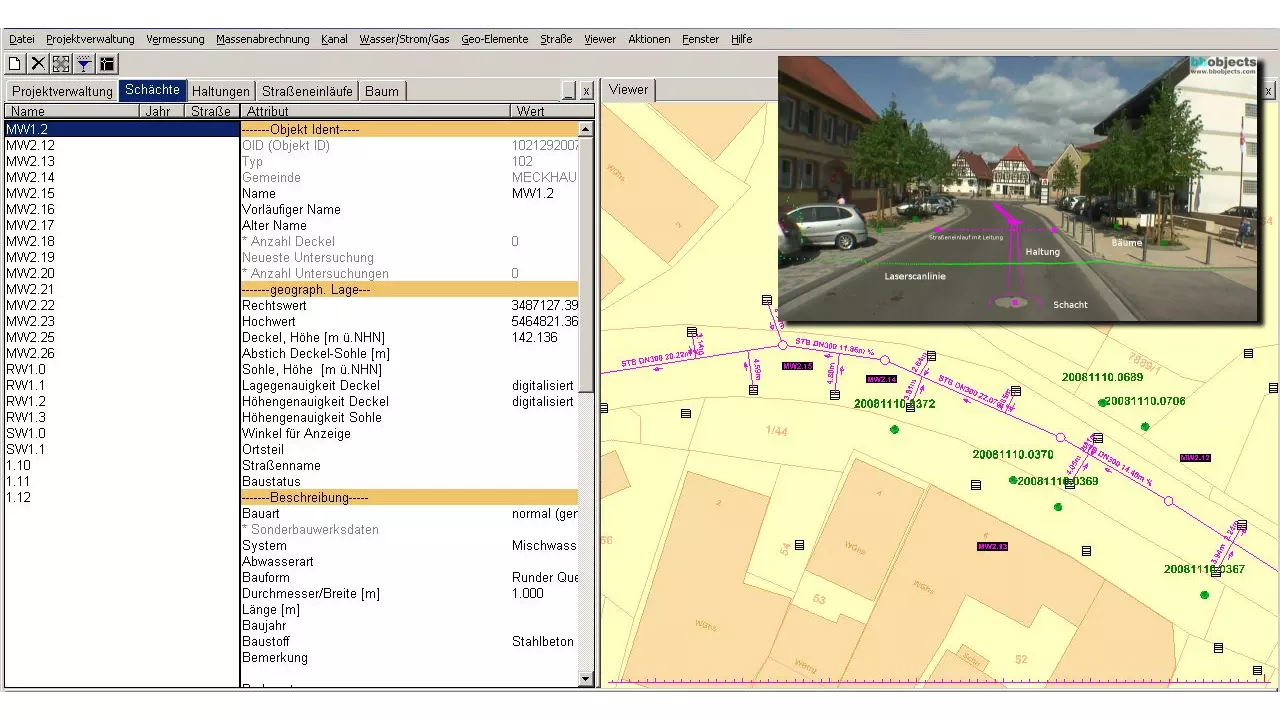
- traffic area (lamp, sign, condition)
- building