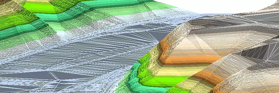
DTM from Laserscan
Our civil engineering software makes the usage and the processing of enormous grid-laserscan data possible. These is provided in high resolution from the responsible authorities of the federal states (format: tile in grid). The grid-laserscan data contains already georeferenced, in a grid arranged points, which describe the ground level.
Further features:
- for a low capacity utilisation of the CAD: laserscan data is always stored in the project directoy and is not loaded into the CAD
- via a constructed reference to the tile the information about height can be interrogated within seconds off the CAD
- no thinning out of data: this is available to the full extent
- the processing of surface analyses, infrastructure planning and profiles is possible over several kilometres
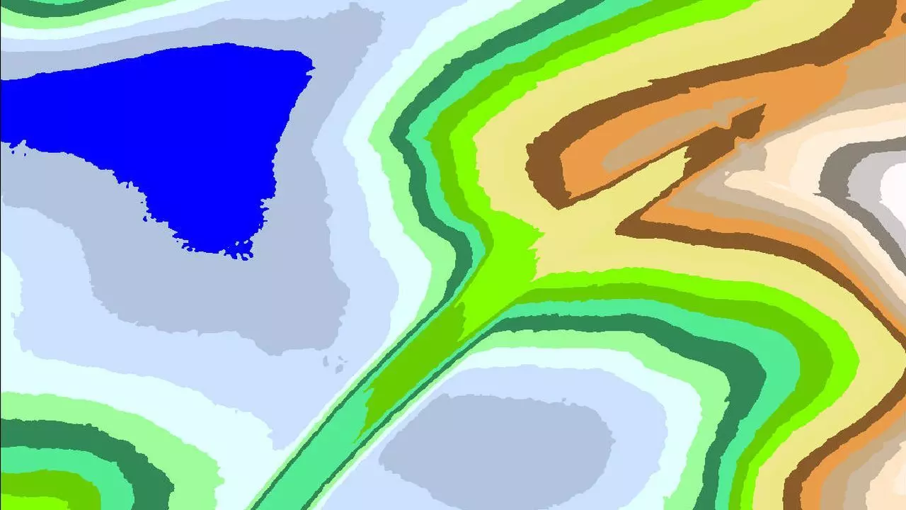
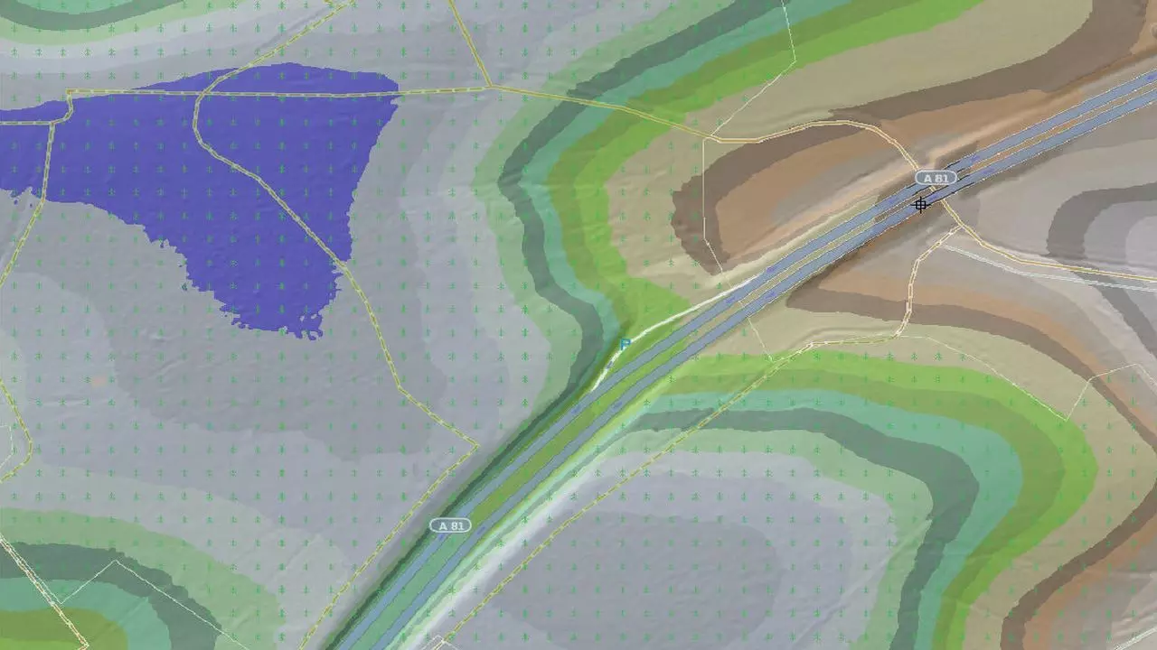
- considerable visualization with the help of all functions from the DTM-analysis: e.g. contours, contour levels and inclination- or flow arrows
- during import of laserscan-tiles the formats from the federal states Hesse and Lower Saxony are supported too
- if a UTM/GK-meridian strip is not deposited in the tile, it can be inserted easily via a dialogue
- a rectangular basic form is not mandatory precondition for a laserscan tile: also "fragmentary" tiles were imported in constant position
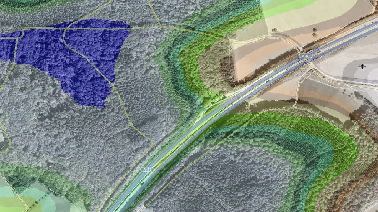
- optionally overlay of Open Street Map data (OSM) for each tile
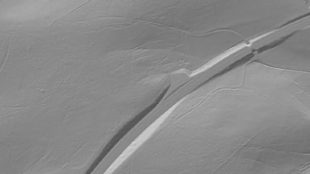
- the generation of Hillshade surfaces is possible: this gives the user a spatial impression of the relative altitude differences in the terrain
- plausibility check of laserscan data is possible
- direction of the points in a tile: right to left and from above to below is possible too
required modules: BB-VGR, BB-VDGM