Broadband cadastre
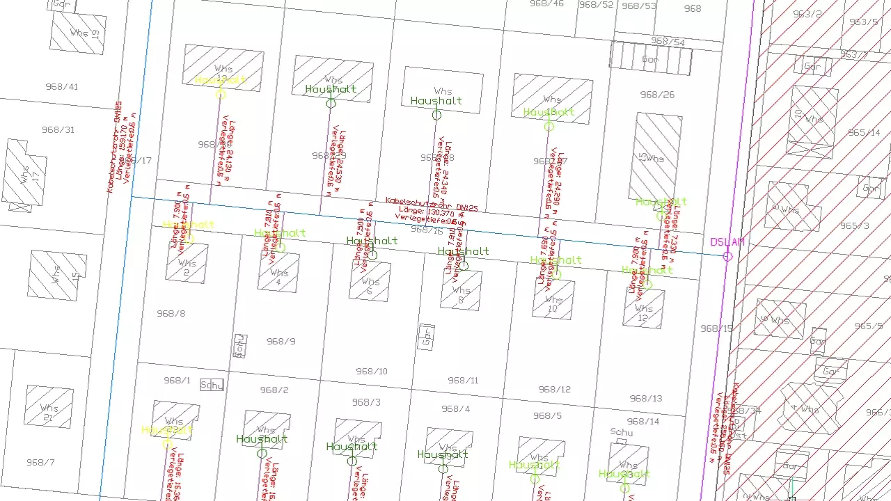
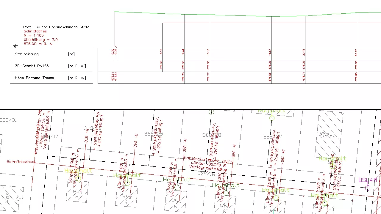
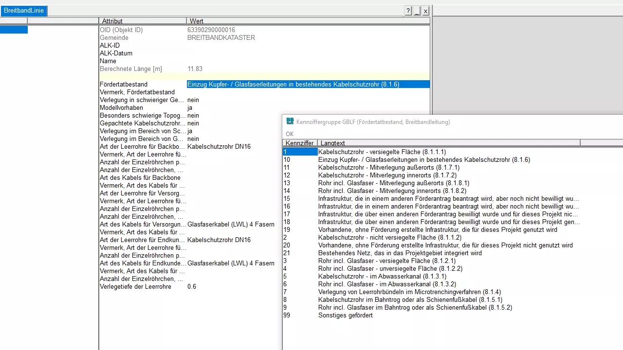
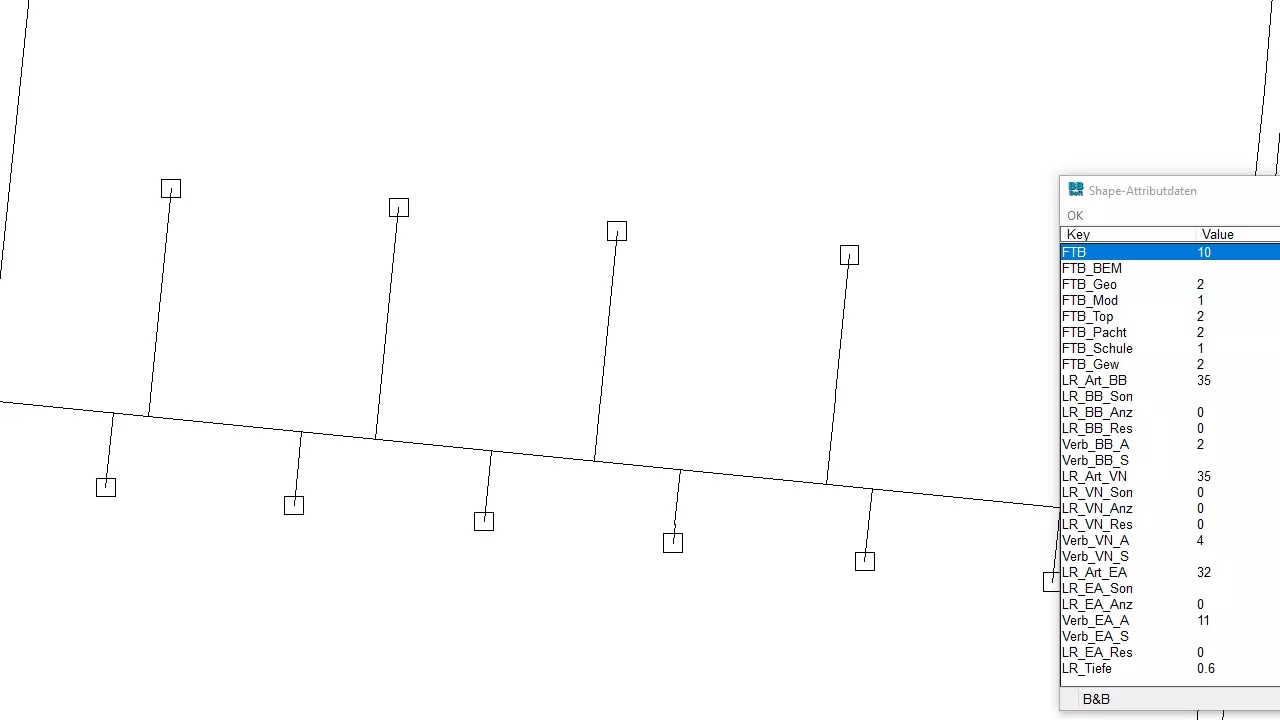
With the module multimedia-broadband-nets of BBSoft® you can plan, maintain, illustrate and evaluate punctate (nodes), linear (conduits/pipes) and extensive objects (area). This broadband-cadastre facilitates the SHAPE-export as support for requests for broadband subsidies, at the moment version 1.1. The whole structure of this geo-element is based on "GIS-Nebenbestimmungen (GIS-NBest BW)", at the moment version 1.2 from 30.06.2023. General information can be recorded in the GIS-database to nodes (e.g. construction types, usage), lines, conduit types, conduit diameter and areas (including network areas, usable areas). Specific advice to the construction/acceptance date or to regular appointments of the broadband net can be managed. Subsequent editing of data and of captured or planned network areas is unproblematically possible.
Further features:
- output of adjustable lists with numbers, lengths, construction type
- SHAPE-export: based on "GIS-Nebenbestimmungen"
- a visually appealing display in the location plan with symbols for e.g. consoles, fibre optic couplers
- different conduit types can be displayed and inscribed very well
- the creation of own symbols and namings is easily possible
- technical data of broadband-objects can be displayed as list or in terms of detailed overviews with picture
- a consistent data management is constituted by GIS
required modules: BB-VGR, BB-GEGR, BB-LGGR, BB-VSHPKML, BB-GMBN