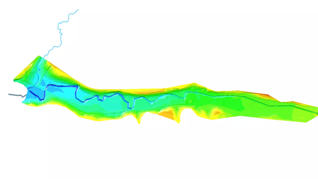
Dike planning
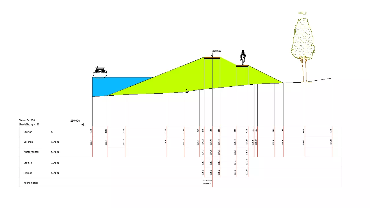
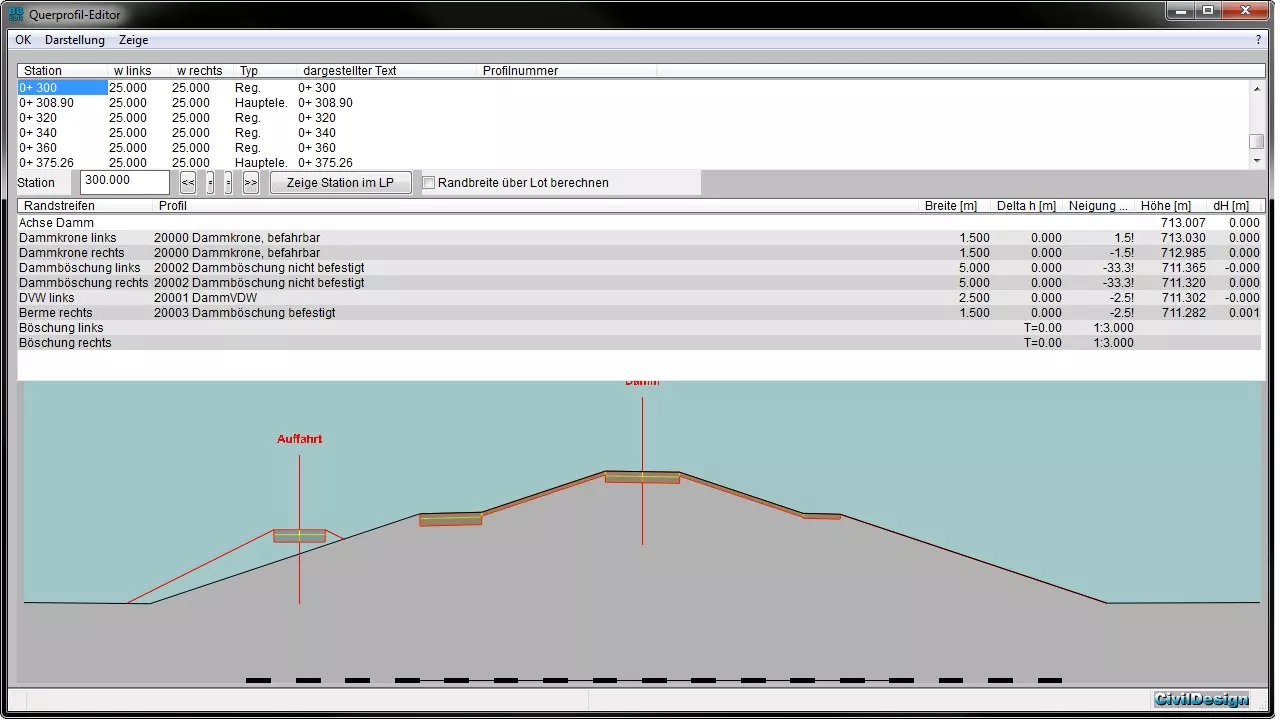
An alignment is specified on the basis of a terrain model by the water-/dike planning. The alignment can be made up of CAD-lines or she can be modelled with the alignment construction of the civil engineering solution "location". The planning in a longitudinal section allows an accurate definition of height and falling gradient of the crest or rather of the channel bed. Further information, like ground levels, stations of the location plan as well as crossing elements, can be illustrated synchronically also in the longitudinal section. The user defines dam embankments, service ways and retention areas while he is supported by a dialog. At this point it is also possible to indicate specifications of heights, widths and slopes. If materials and embankment proportions are familiar you could use these as well. A comfortable planning is possible through consideration and displaying of constraining heights, borders or bridges. The user experiences the maximal support through lists of material and water profiles, which he can configure freely.
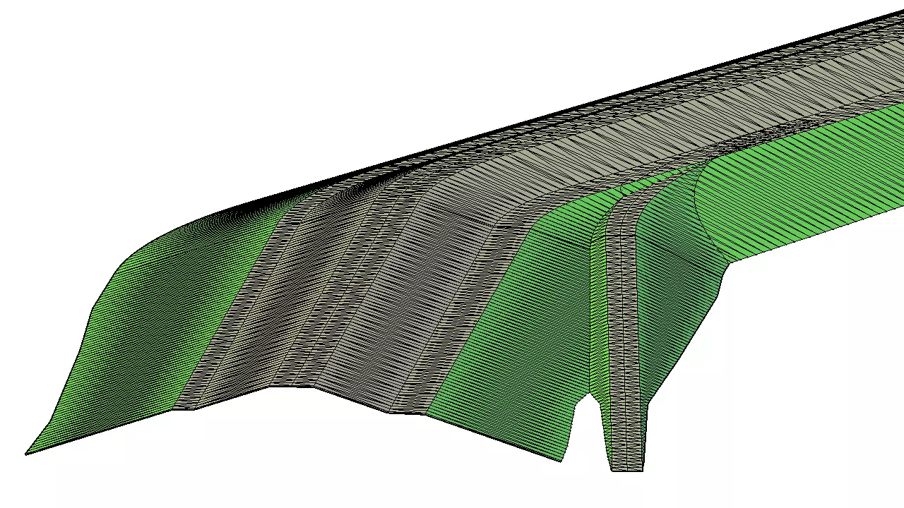
The cross-profile editor offers the opportunity to move through the scheduled water-/dam body. The "Show"-order draws every favoured cross-profile as a CAD-element with desired text-dimensions, scale and as well hatch patterns. Crossing elements like borders, counduits or cables, are also illustrated. These are drawn differently corresponding to their type. Naturally at this time also the vegetation or trees are discernible. The program distinguishes between the diverse levels through the selection of the terrain models. Therefore different gauges can be simulated or rather measured and without any further graphical effort the cutting line, inclusive the filling of the surface, can be represented in the CAD. The DA51, 53, 54 and 66 can be imported and exported for the mass confirmation, apart from the data of the alignment in form of the data type 21, 40 and 50. As an additional examination a record of the alignment is written. Ground levels of dam or rather flume can be displayed as ASCII-file. The results are transferred to hydraulic calculation programmes (Jabron, Rehm, WSP-WIN, WSP-ASS) by means of DA66. BBSoft® makes with LandXML a channel of communication available, which is to this time in the world of civil engineering the latest!
required modules: BB-VGR, BB-VSTR