Drainage
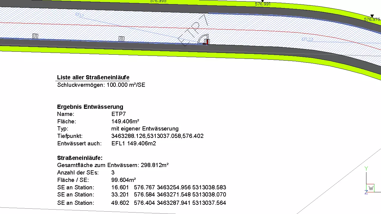
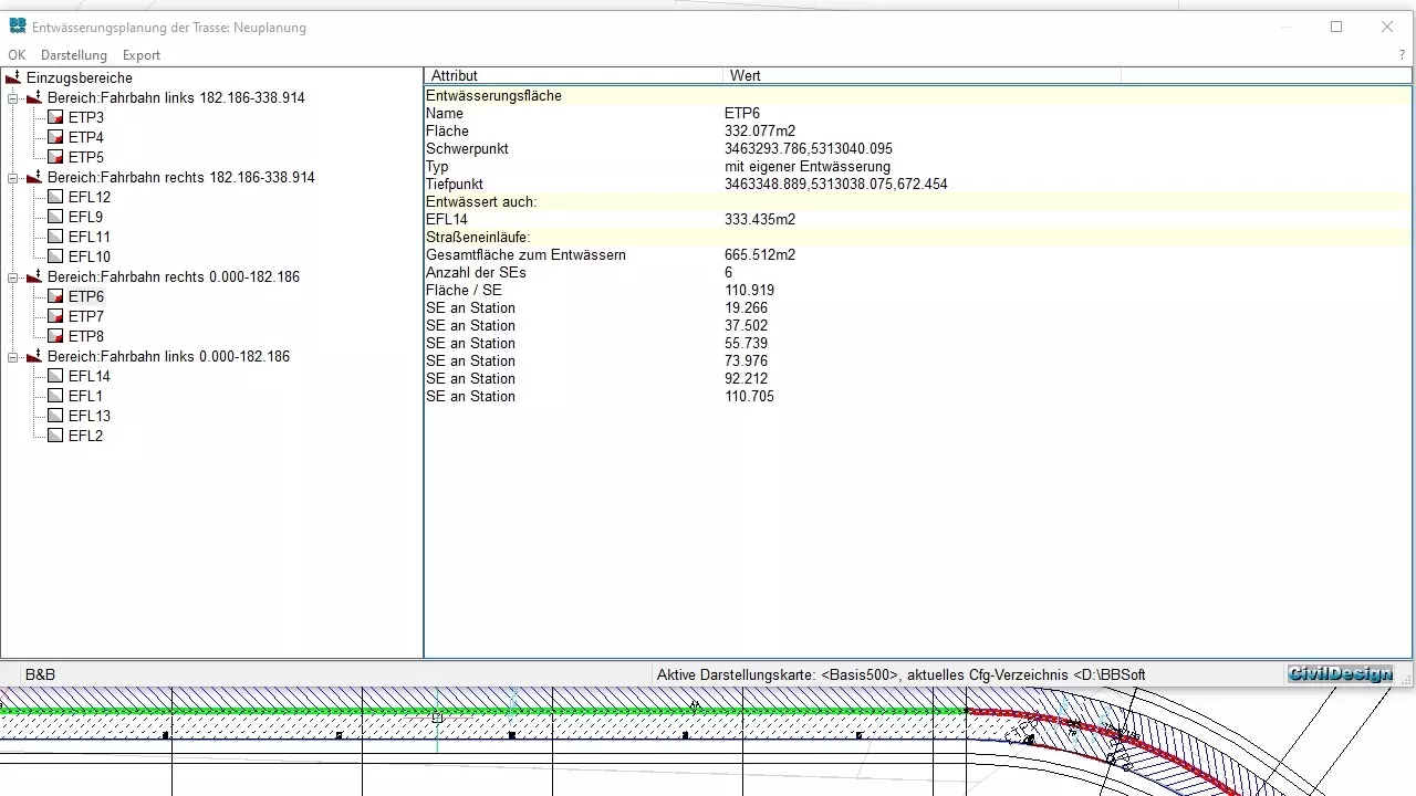
The surface drainage takes a high priority in the road planning, given that the structure and the traffic safety could be at risk. The program calculates the number of road gullies and places them automatically in the location plan on the basis of the ascertained drainage area and a predefined absorbing power.
Further features:
- calculation and analysis of catchment areas takes place based on RAS-EW
- graphically appealing illustration of drainage areas and low points inside route
- clear listing of all drainage low points
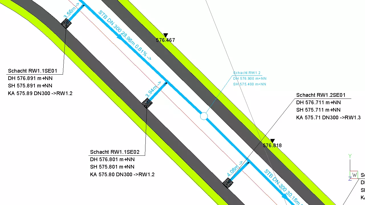
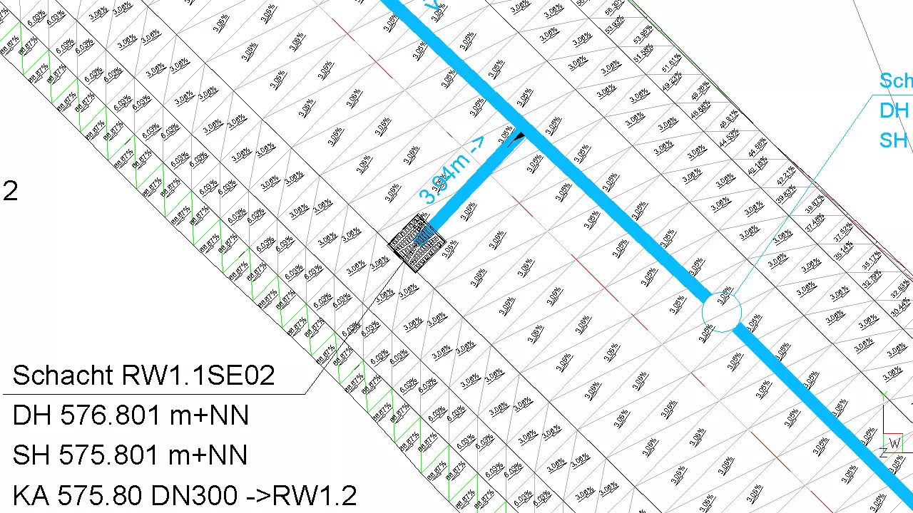
- tagging on which side of route it will be drained
- marking in the location plan, if longitudinal gradient declines below 0.5%
- absorbing power can be defined freely
- partial areas will be added together and are integrated into a calculation
- road gullies can be spread automatically and can be connected with an existing sewer system
- output of road gullies with related coordinates
- road gullies can be added subsequently, can be shifted to another station or can be deleted
- flow arrows can be displayed for a visual control
required modules: BB-VGR, BB-VSTR