Presentation
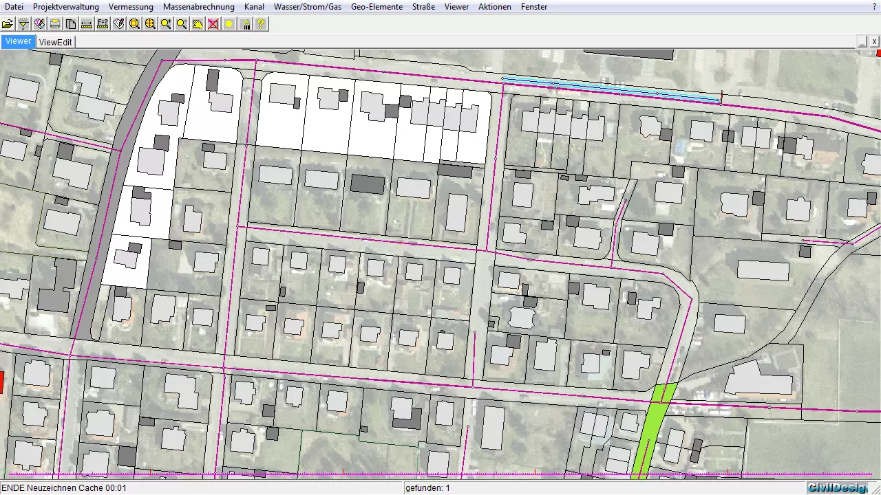
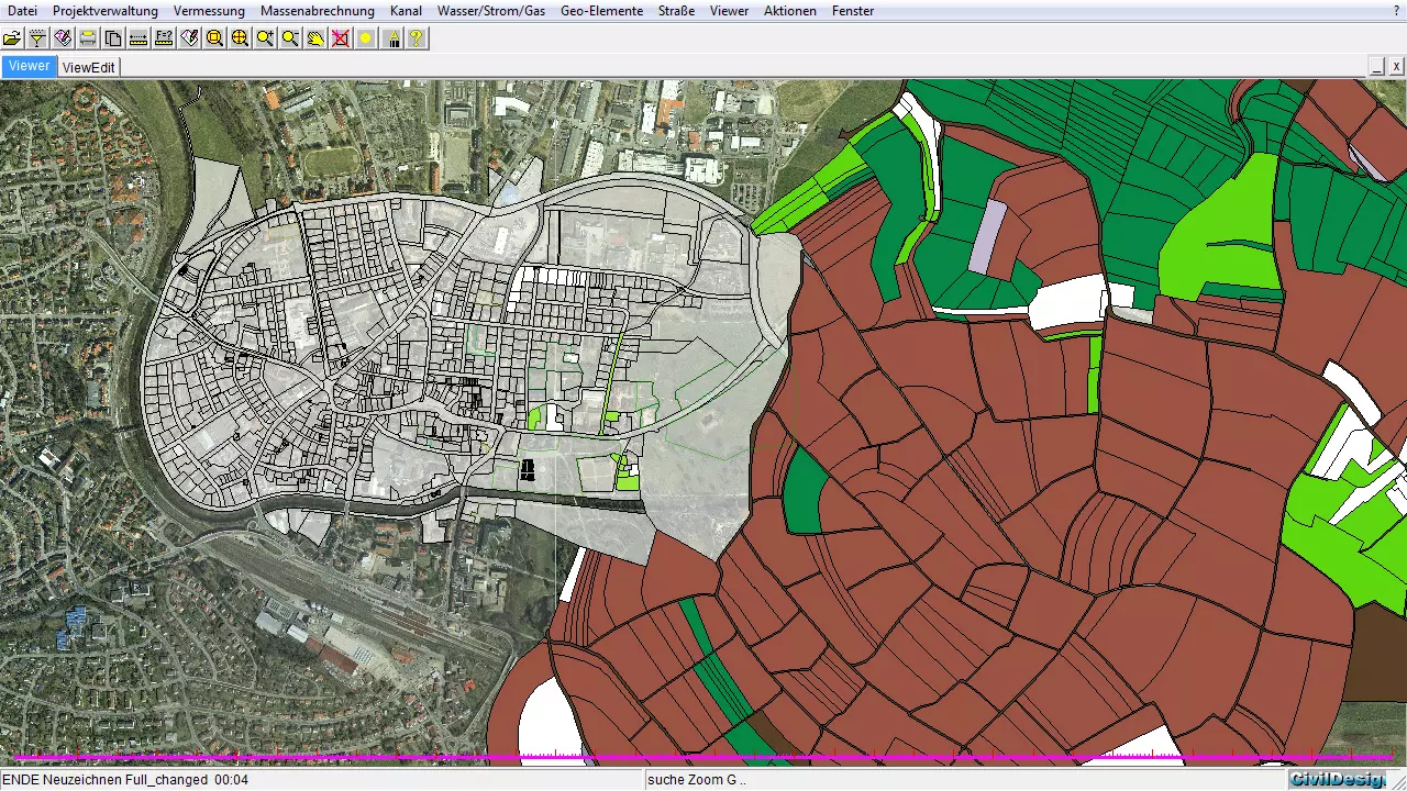
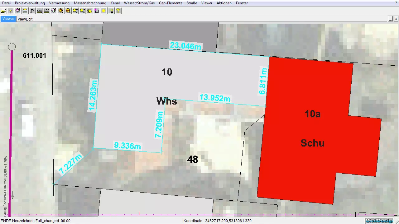
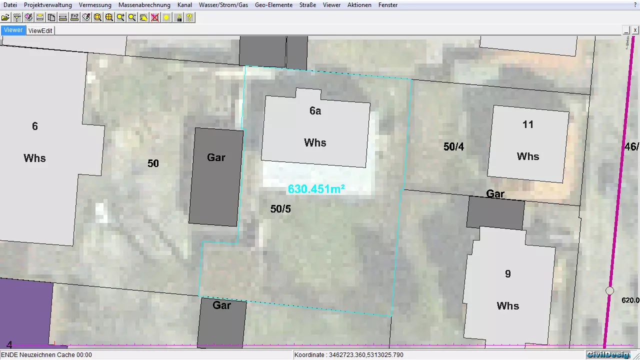
The presentation of the GIS-data, like for example for the groups sewer, water, power and for all further application modules, occurs at the BBSoft®-viewer. This displays the geographical position of the technical data from the Oracle®-database and serves for the graphical presentation.
Further features:
- single objects (e.g. houses or green areas) can be displayed in the GIS-viewer
- with the help of an filter-editor it can be searched for special technical data (e.g. according to the name or to the use)
- the technical data regulates the presentation (e.g. colouring of the buildings and inscription of the parcels of land)
- the information content within the viewer is dependent from the adjusted scale
- multiple layers can be selected simultaneously for a differentiated presentation (e.g. buildings, house connections and green areas in one figure)
- a full-scale printing of the view in the viewer-window is possible (e.g. 1:100, 1:250, 1:1000)
- distances between objects or complete area sizes can be measured in the GIS-viewer
required modules: BB-GVIEW